Submitted by Tess Buchannan
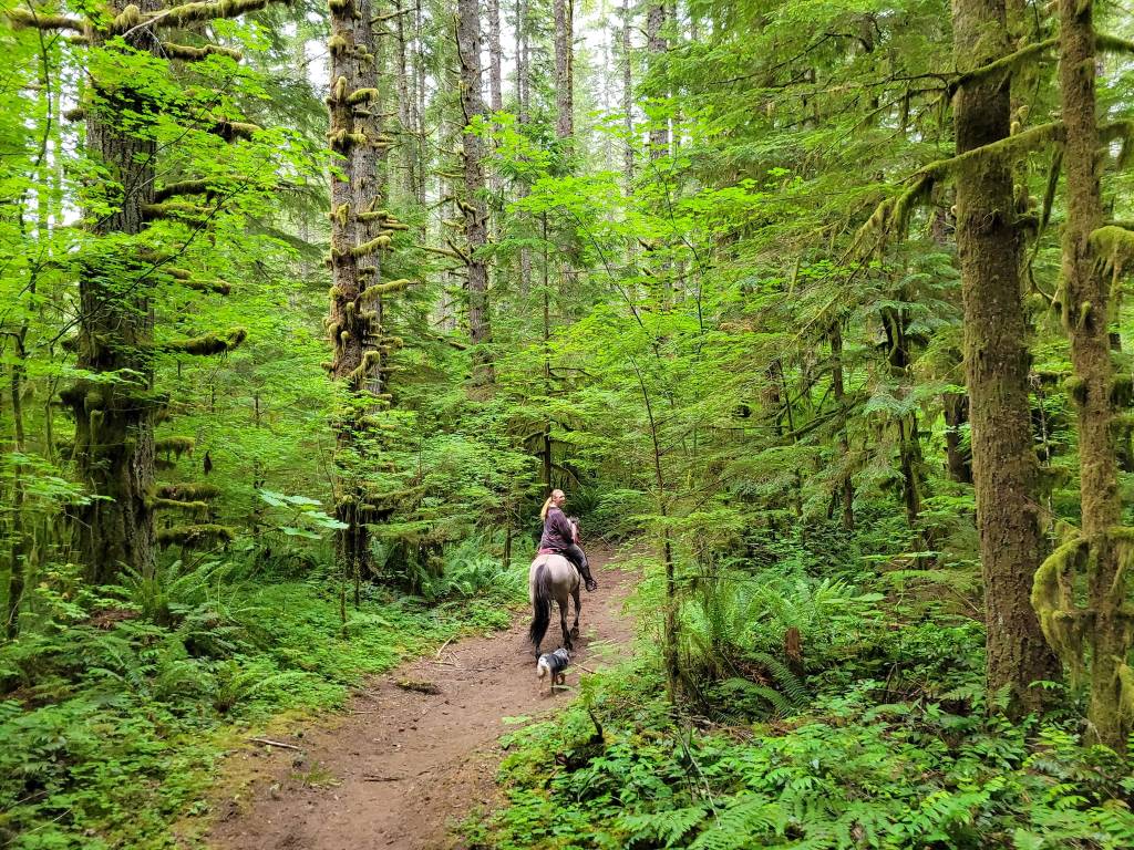
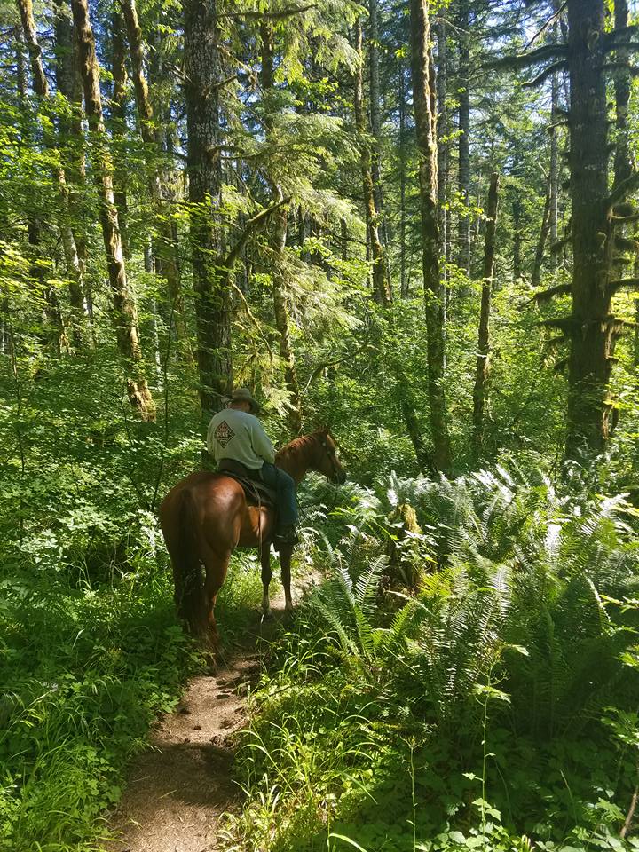
Milo McIver is a popular park for equestrians. Boasting easy trails, an obstacle course, river access and very close to the Portland metro area. The trails are rideable year round and if you catch the right time of the year you will be treated to lovely fall color.
Trail Stats:
- Rivermill Trail: 5 miles
Estacada Lake Trail: 1.4 additional miles
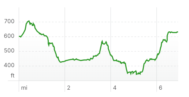
Homestead Loop: 1 mile - Elevation Gain: 469 feet
- Elevation Loss: 459 feet
- Max Elevation: 704 feet
- Difficulty: Easy
↗ What does this mean? - Footing: The trails are very well maintained dirt trails with some gravel sections. Can be slippery on hills during wet weather. One longer rocky stretch on a hill.
- Hoof Protection: Barefoot OK.
← Back to Trail Catalog
← Explore more trails in the Portland Metro area
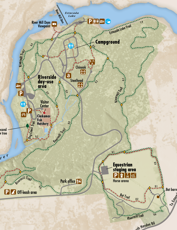
Facilities: The trailhead includes a porta-potty, a shelter and several picnic tables, and an enormous amount of parking. Pack out your manure! There are several mounting blocks, a hose with water (in warmer months). A roundpen with good footing offers a warmup area, as well as an outdoor “arena” with one open section on the wall. There is a hitching post next to the hose to make bathing post-ride easy!
Water Sources: Hose at parking area.
Trail Info:
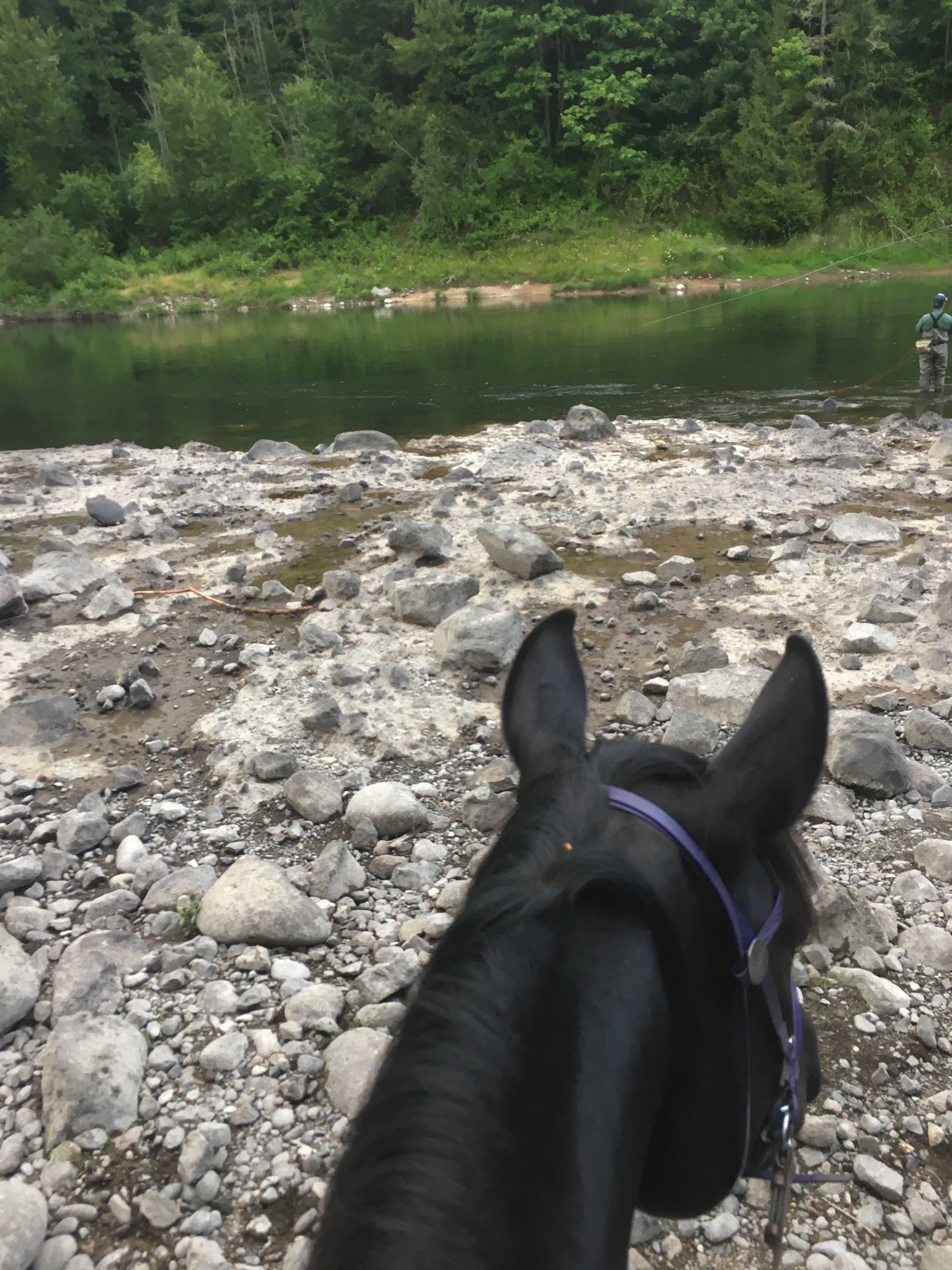
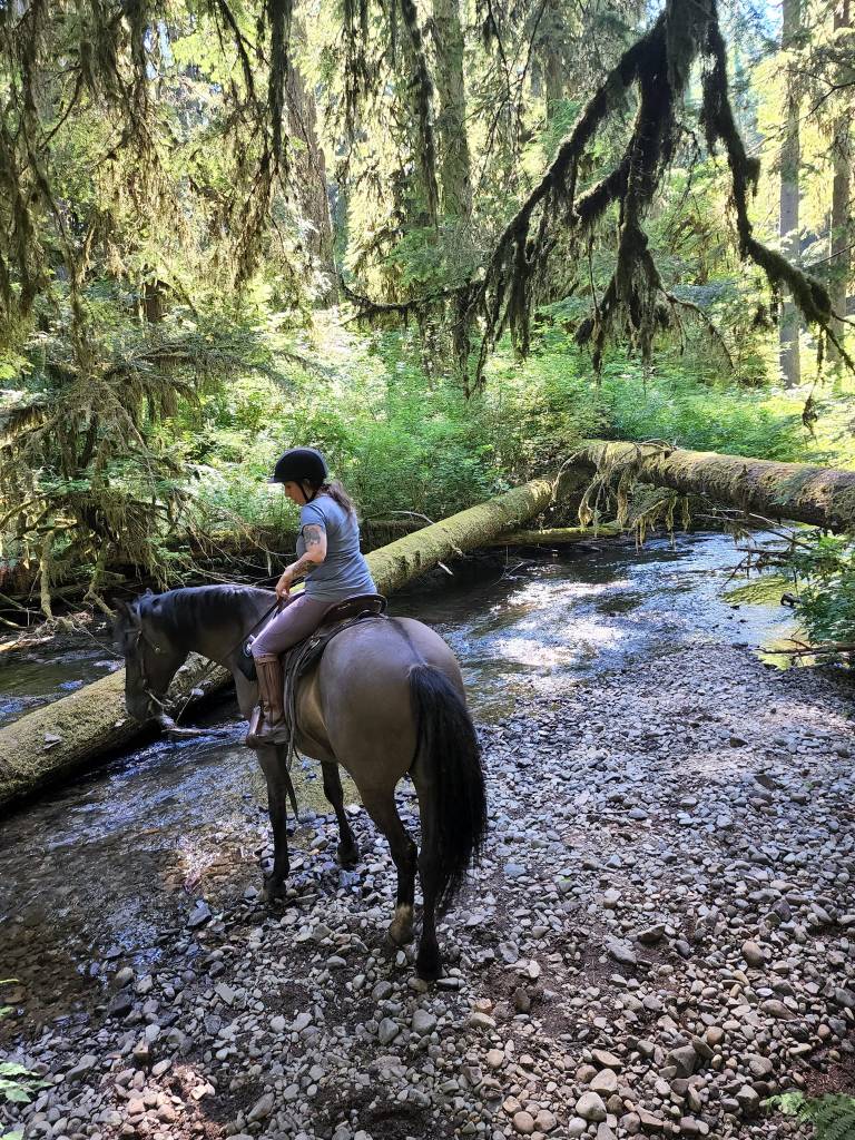
Rivermill: From the equestrian staging area, head out east for 0.1 miles, keeping left at the fork with the Homestead Loop, and left again at the signs for the Estacada Lake Trail. Ride on 0.7 miles, then keep right to go around the campsites. You will ride 0.4 miles along the Clackamas River (with a spot to ride down to the water, if you choose), then climb 0.2 miles back uphill. The trail zigzags 0.2 miles here before the bridge. Keep right to finish the trail out – the left turn returns to the loop. From here, there’s a 0.9 mile stretch headed west, then a brief 0.6 mile jaunt through the fields along (but well away from) the road. Be very aware of the nearby off-leash area.
Homestead: This smaller loop contains obstacles or “training stations” built by volunteers with the Oregon Equestrian Trails. Each obstacle is beside the trail, so that you can choose to ride past it rather than engage. These include: a teeter totter, a suspension bridge, a gate, a back-up chute, step over logs, cavelletti poles, a balance beam, and a water crossing. From the equestrian staging area, head out east for 0.1 miles, keeping right at the fork with the Rivermill Trail. Continue 0.4 miles, crossing obstacles as you go. The trail passes by the “Bat Barn” and offers great views of Mt Hood. The last 0.6 mile stretch is a little more varied in elevation gain and loss, and loops right back to the trailhead.
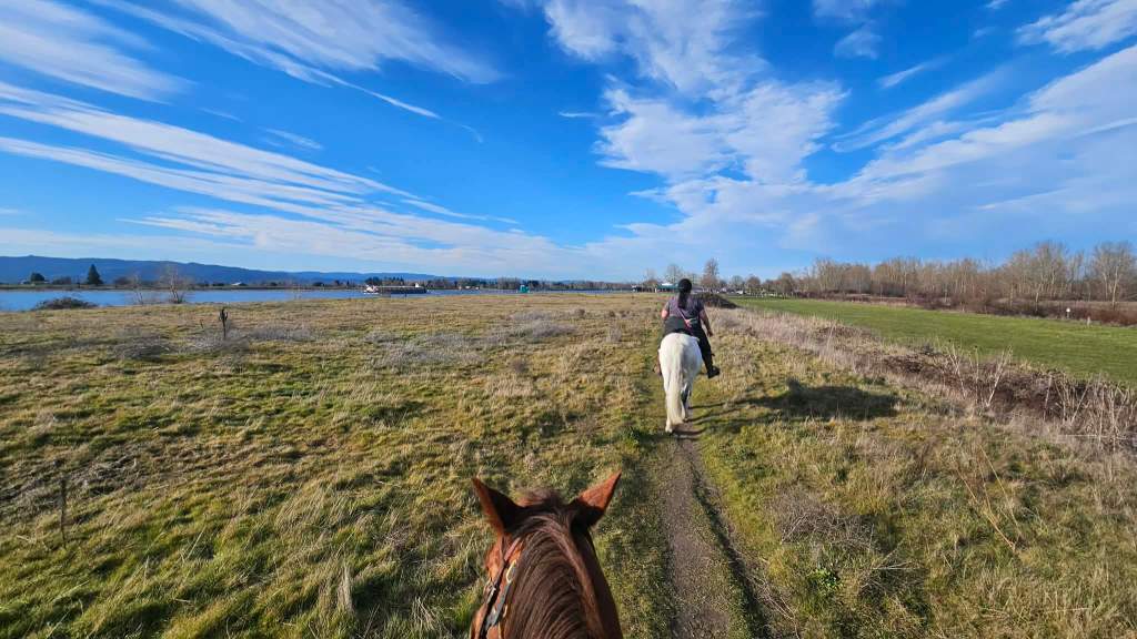
Estacada Lake: Choose to take the right-hand fork off of the Rivermill Trail for a little extra elevation gain and a long straight stretch alongside ‘Estacada Lake’ that can be galloped, with clear sightlines and fantastic footing.
Trail Challenges: There is a short bridge over the creek. There are lots of pedestrians on this trail. The optional obstacles provide a low-stakes environment to test greater challenges. Mountain lion sightings are fairly common in the park.
Permits/Fees: An Oregon State Park pass is required, although a day use fee can be paid at the entry. Day use fee for Oregon residents: $10, non-residents: $12.
Backcountry Sites: No suitable for overnight use.
Cell Service: Verizon works throughout the park.
Fuel: Redland Station – 18150 S Redland Rd, Oregon City, OR 97045
GPX File: OHT: Milo McIver
Maintained By: The horse facilities at Milo McIver State Park are maintained by the Oregon Equestrian Trails organization. They hold poker rides, workdays, and fundraisers to keep these trails up. Please consider joining as a member, contributing to trail maintenance or supporting their fundraisers.
Directions: From I-205, take Highway 224 to Estacada. Turn south on Highway 211 and go 2 miles. Turn right on Hayden and go 1 mile. Turn right onto Springwater and go 1.5 miles to park entrance. Follow “equestrian trailhead” signs from the entry; keep right; it is the last parking area. Be aware of speedbumps.
Map:

← Back to Trail Catalog
← Explore more trails in the Portland Metro area


If you’d like more PNW trails straight to your inbox, be sure to subscribe!

Leave a comment