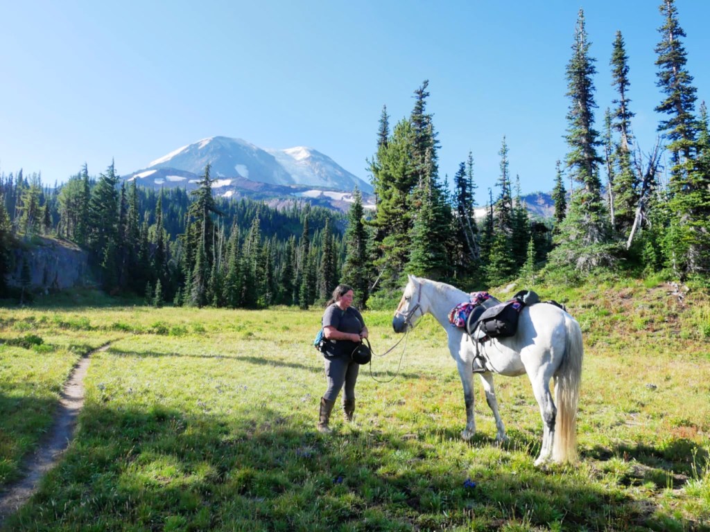
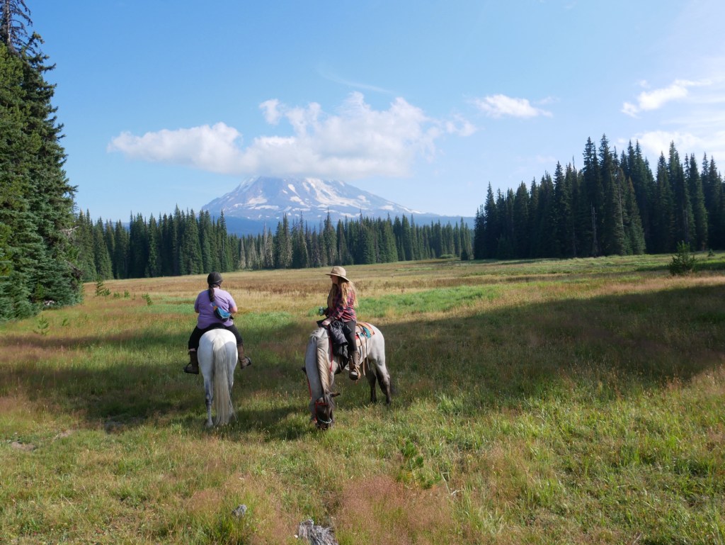
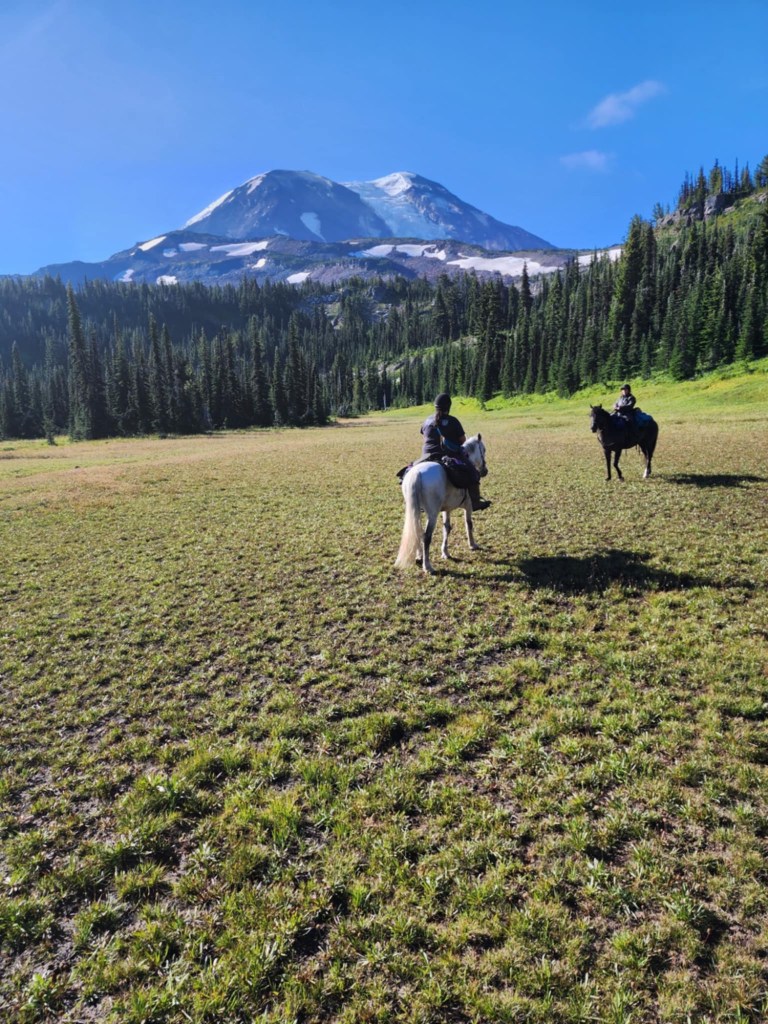
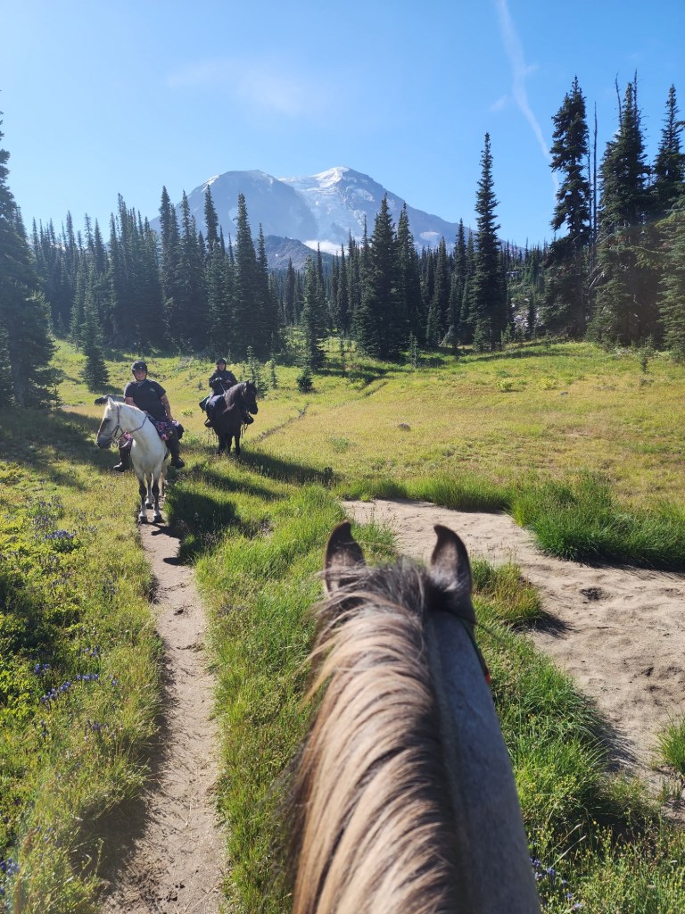
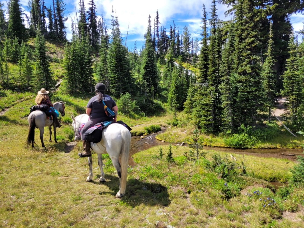
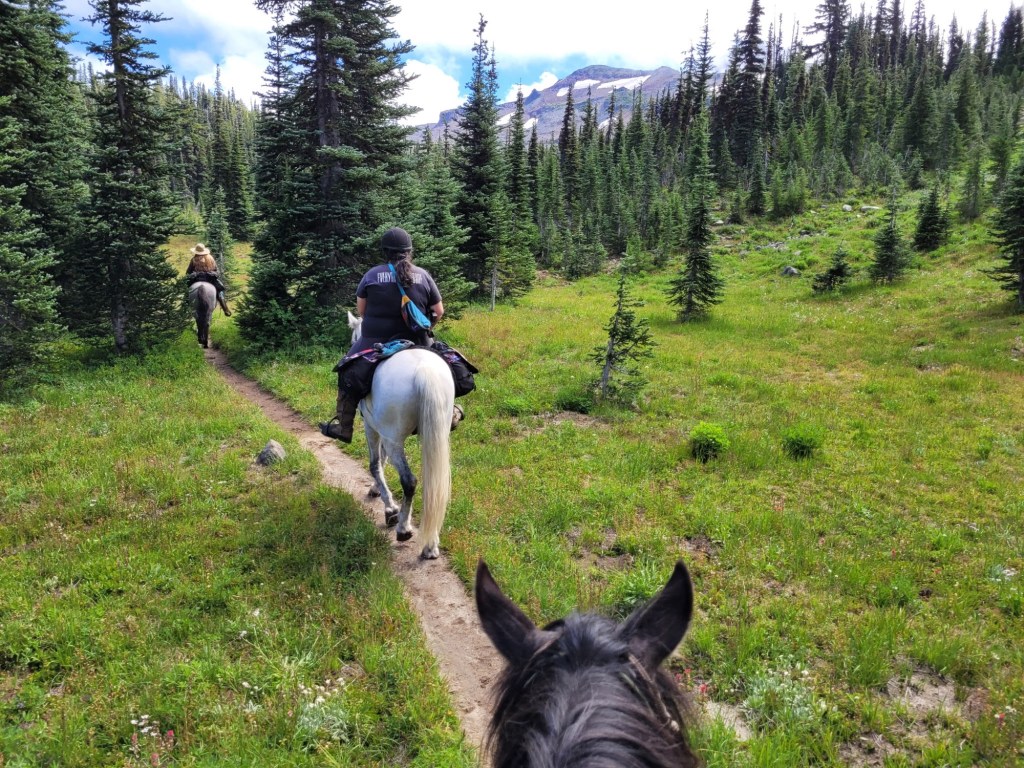
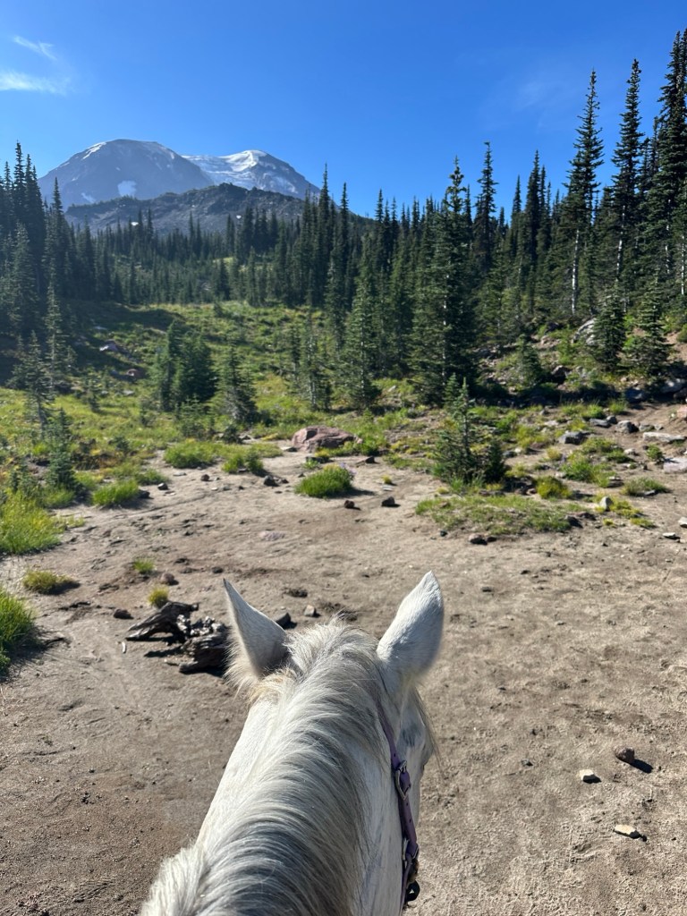
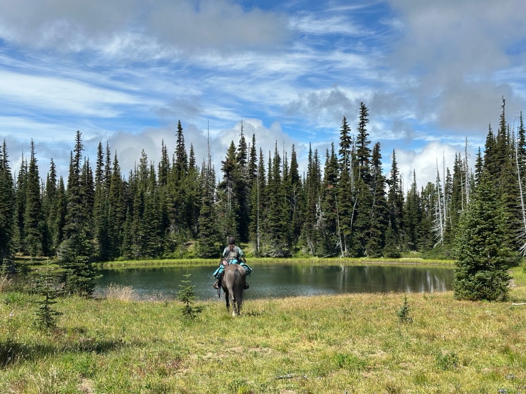
This loop is hands down in my top 3 favorites. It has a short window of season that it’s ridable and is best ridden in August for weather and wildflowers.
This trail features high alpine riding, close up views of Mount Adams, wildflowers, crystal clear streams, alpine meadows, stunning unnamed lakes – all in under 13 miles.
Trail Stats:
- 12.2 mile loop
- Elevation Gain: 1954 feet
- Elevation Loss: 1957 feet
- Max Elevation: 6120 feet
- Difficulty: Difficult
↗ What does this mean? - Footing: Mostly single track dirt trail, some large rocks to navigate and some shale rock on Muddy Meadows Trail.
- Hoof Protection: Optional but recommended for sensitive horses.

← Back to Trail Catalog
← Explore more trails in the Southern Washington Cascades
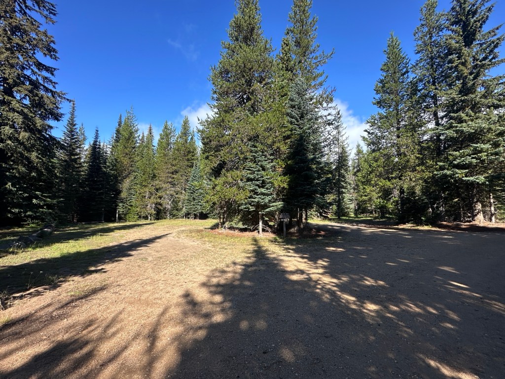
Facilities: Day use parking at Keenes Horse Camp. No fee for use. Parking can accomodate large rigs. Additional dispersed spot past Keenes Horse Camp on the right side of road. Small dispersed site off of Muddy Meadows Road at the right hand fork.
Water Sources: Stock tank and nearby creek. Stock not allowed at creek – use buckets. No potable water.
Trail Info: Starting from Keenes Horse Camp day use parking, pick up the Killen Connector Trail #113A out of the south end of the camp loop. Continue on this trail for 1.8 miles until you cross the road to the Killen Creek Trailhead. From the trailhead follow Killen Creek Trail #113 for 3.3 miles until you reach the junction with the Pacific Crest Trail (PCT). Turn left on the PCT and ride 3.6 miles. Turn left on Muddy Meadows Trail #13. Ride 2.9 miles to exit at the Muddy Meadows Trailhead. Ride 0.4 miles on the Old Keenes Trail back to the main road and ride back to camp. Alternatively you can ride back on Muddy Meadows Road from the trailhead.
Trail Challenges: Elevation gain. Killen Creek Trail has large steps in trail for water erosion control – recommend going up the steps counterclock wise rather than coming down them. Some are very tall and horse should be fit. Some narrow trail but not extreme. Some technical rocks to navigate. Water crossings. Bridge crossings. Bridge on PCT near waterfall is old and starting to bend under horse/rider weight. No great stock crossing. Dismount to cross bridge.
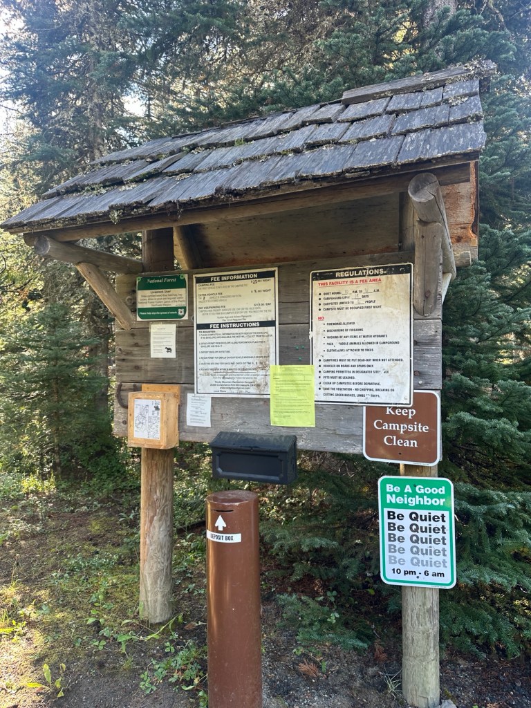
Permits: Self-issue wilderness permit at Killen Creek Trailhead or Muddy Meadows Trailhead.
Backcountry Sites: Many on northbound PCT from Killen Creek Trail.
Cell Service: None. Closest signal is 2 hours away in Randle, WA.
Fuel: Nearest fuel is the 76 in Randle, WA before the turnoff to Forest Road 23. If you are willing to drive 2 miles further, gas is almost $1 cheaper at One Stop. Both have diesel.
76 Gas Station – 9801 US-12, Randle, WA 98377
Randle One Stop – 10114 US-12, Randle, WA 98377
GPX File:
WHT: Killen Creek/PCT/Muddy Meadows
Directions: To Keenes Horse Camp.
Do NOT follow your GPS/Google. There is a major washout that is impassable to trailers or even some vehicles.
From Randle, Washington travel south on State Highway 131 (Forest Roads 23 and 25). Veer left in 1 mile at the Y of Forest Road 23 and Forest Road 25. Continue to follow Forest Service Road 23 for 18.5 miles then turn left onto Forest Road 21. Follow Forest Road 21 for 4.6 miles and turn right onto Forest Road 56. Follow Forest Road 56 for 3 miles and turn right onto Forest Road 5603. Follow Forest Road 5603 for 5.2 miles and turn right onto Forest Road 2329. Follow Forest Road 2329 for 2.5 miles and arrive at the campground on your left.
Map:

Video Footage Link Here
← Back to Trail Catalog
← Explore more trails in the Southern Washington Cascades


Leave a comment